|
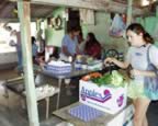
Log - 10/9/2002 to 11/21/2002 This log page describes the journey from Santa Rosalia south along the central Baja coast, then across the Sea of Cortez to Mazatlan. This page includes the following sections: Santa Rosalia (Oct 9, 2002 - 27° 20.41' N and 112° 15.91' W) After leaving the Midriff Islands, we sailed south to central Baja California and stopped for four days in Santa Rosalia. At Santa Rosalia we fell into our typical marina pattern and took care of some boat work, get water and fuel, and let Katherine try to put together another telephone interview for short-term work. The little, 12-boat marina sits inside a man-made breakwater along with a hundred pangas and the filthiest seawater in Mexico. The funky Santa Rosalia marina supplies beer, soda, and laundry machine use on the honor system. In spite of the three-knot harbor speed limit, during the evening the maniacal panga drivers zip by the gringo boats at speed up to 25 knots and leave large wakes to jostle our peaceful repose. The town is refreshingly different than other Mexican settlements. Santa Rosalia was originally a French-run mining town created in the late nineteenth century. There are wooden buildings (unusual in Mexico) and a small church designed by Mr. Eiffel himself (however the Eiffel tower is vastly more interesting). Wandering South (Oct 12, 2002) Heading south from Santa Rosalia, we explored Isla San Marcos, Punta Chivato, and Playa Santispac. Santispac is a popular anchorage in popular Bahia Conception, where a bunch of boats gathered to celebrate Gwen's (of s/v Tackless II) birthday. We hitchhiked fifteen miles from Santispac into the oasis town of Mulege, and were delighted by the number of trees and good drinking water. The birthday parties were fun, but after a few days, it was nice head south and away from civilization. We left Conception Bay with benign wind predictions that would allow us to explore some of the less protected anchorages which dot the coast for 50 miles southward. But, sometimes the weather doesn’t cooperate. Our first stop at Los Pillars provided some ho-hum snorkeling, so we decided to move on to the next anchorage – then the wind decided to tease us. The wind provided gentle windward sailing, but the direction sent waves into the bays we had hoped to stop at; so, we continued onward. At the end of a long, pleasant sail, we did our first anchoring at night at La Ramada (the first well-protected cove south of Bahia Conception). Making landfall at night is always a risk, but we were not too worried because we were familiar with La Ramada and we had ample moonlight. The next morning we wieghed anchor and moved to nearby Bahia San Juanico (25° 25.77' N and 111° 15.77' W). It was great to be back to the middle of nowhere, with nice snorkeling and plenty of seafood to catch. Our diet expanded beyond fish to include scallops, lobster, and clams. Agua Verde (Oct 28, 2002 - 25° 36.64' N and 111° 07.72' W) After quick stops at Isla Carmen and Puerto Escondido. moved down to Agua Verde - a lovely, well-protected bay with a nearby microscopic village. In Agua Verde a local goat farmer makes the best cheese in Mexico.
For one day we had the Agua Verde anchorage all to ourselves; then, more and more boats just kept on arriving. Luckily, the other vessels included Lady Galadriel, Tackless II, Ryokosha, and Loncia - so we were able to play, snorkle, and socialize with some of my favorite people. We spent a long time anchored at Agua Verde (eight days). During that time it was also the least windy (and flattest water) we've seen in the Sea of Cortez. This was great for snorkeling, but the wind generator was ineffective. But, we did get to crank up the noisy gas generator - and use it to drive away a powerboat that anchored excessively close to s/v Squiz (TGN). On Thursday we transited down to Los Gatos, for some reason Squiz really likes it here. After a couple days of dining on lobster and scallops, the first "norther" of the winter season was forecast; so we moved down San Evaristo that provides a more sheltered anchorage. On the short, ten-mile, sail from San Evaristo to Isla San Jose, we tried something new. The entire passage - including raising the anchor, sailing to the island, selecting the anchoring spot, and dropping the hook - was done without the aid of the engine. A satisfying learning experience, but I won't be trading in the good old Perkins diesel anytime soon. We continued to use up our provisions and lighten TGN as the days progressed toward our time for crossing the Sea to Mazatlan. The ice box and the refrigerator were nearly empty; and, Katherine timed it that we even ran out of flour, white sugar, a few other staples. Crossing to Mazatlan (Nov 19, 2002 - 23° 16.29´N, 106° 27.27´W) Upon hearing forecasts for a Norther (a nasty north wind), we abandon the poor shelter offered by Isla San Jose, and anchored at nearby Isla San Francisco (about 50 miles north of La Paz). After waiting out the worst of the Norther, a narrow window of decent weather appeared in the forecast. So, after much hemming and hawing, we left Baja for the 2 - 3 day crossing to Mazatlan. The wind and waves were initially a bit higher than we like, but we zipped along at 7 knots, using only a doubly reefed mainsail and the staysail. That afternoon the wind reduced, and we actually sailed TGN like the cutter she is - and flew the main, staysail and jib. But the best sailing occurred that night. With a nearly full moon, the Leonid meteor shower, and a light breeze we slid softly across the sea with the big drifter (which is similar to an asymmetrical spinnaker). Unfortunately, another nasty Norther appeared in the weather forecast. We wanted to get to Mazatlan before the wind-generated waves grew to a point that the entrance to the breakwater became perilous; so, during the breezes of second day, we motorsailed for several hours. In the end, the predicted Norther never appeared. We made the 255 nautical mile crossing in 46 hours. This average speed of 5.54 knots is surprisingly brisk for a Tayana 37. As usual, pulling into a marina in a city switched us into project/maintenance
mode. After a bout of cleaning and desalting everything, Katherine
is performing maintenance on the woodwork and stainless steel; I
am replacing old plumbing and performing engine maintenance.
|
A wise captain carries more ballast than sail.
The sea voyage is more than an adventure; it is a rite of passage,
as decisive as a wedding. It marks the end of the old self and the
birth of the new. Other Related Pages: |
|