|
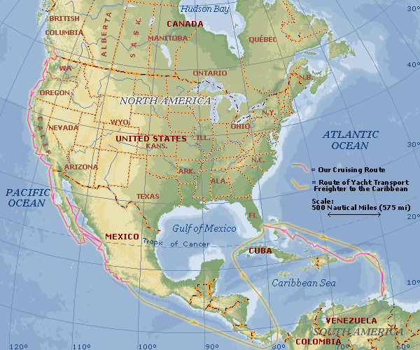
Map & Route - Overview This section illustrates where my sailboat (s/v Squiz) has voyaged since June 2001. To see maps with additional details, click on part of the route shown below, or click on a place name listed to the left. The magenta line shows where we actually cruised. The orange line from Mexico to Martinique, shows the boat's route as it was ferried to the Caribbean by a yacht transport service, in March of 2003. |
|||||||||||||||||||||||||||||||||||||